The Wild Atlantic Way Part 4
County Sligo
A series of articles about locations along this 2500km marked tourist route, which runs from Derry in the north to Kinsale in the south
Leaving County Donegal, you enter the gorgeous undulating landscape of Sligo. This beautiful part of North West Ireland is packed with ancient mysteries, rugged coastline with soaring cliffs and shimmering mountains. Visit Knocknarea where the great Queen Maeve is buried according to legend, and marvel at some of the most prolific and oldest megalithic cemeteries in Ireland.
The Plain of Moytura
It was beautiful to the eye. Miles upon miles of rolling green fields and hills stretching as far as the eye could see. The emerald-green land was glistening in the evening light. It’s places like this that have earned Ireland its nickname: the Emerald Isle. This is the Plain of Moytura in County Sligo, which upon first glance may just seem like a vast expanse of rolling green hills and meadows. As well as its beauty though, this is the location for one of ancient Ireland’s most pivotal battles and greatest stories.
To get to this viewpoint I’d had to turn left out of the Cromlech Lodge and then take the next left. A short way along this road I pulled up beside a sign for the Sligo Way walking trail (a wooden post with a painted image of a yellow man walking). To the right a trail led up over a hill to where I was standing now, Barroe North Round Cairn, a small grassy cairn that sits on a ridge, 745 feet above sea level, and is identified by an ordinance survey triangulation pillar.
The county of Sligo is packed with ancient historical sites and breathtaking landscapes, and this is a great place to start.
The Great Battle
Irish folklore tells of how the Tuatha de Danann warrior Lugh of the Long Arm stood here and directed the great second battle of Moytura between the de Danann and the Formorians, in which they won back control of Ireland and the seat of the High King at Tara.
It’s easy to see how this would be an excellent spot for directing a great battle. Not only does this location give you a perfect clear view of the whole plain, but you also get a commanding view of the whole of Sligo. All the region’s most important megalithic monuments are visible from here: the massive burial cairn of Queen Maeve on Knocknarea mountain, the caves of Keshcorran, Carrowkeel and Carrowmore, Lake of the Eye. Even Croagh Patrick’s distinctive conical shape can be made out in the far distance.
The Lake of the Eye
There is a large lake visible below called Lough Arrow, but just north of this is a small round lake. This is the Lake of the Eye. On this spot, Lugh was protected by his warriors, but when Balor arrived Lugh came down to confront his grandfather. Balor’s evil eye was an incredibly powerful weapon. Legend says that he could shoot poisonous rays from it that killed anyone in its path instantly. But Lugh also had a great powerful weapon, the magical spear, Slea Bua.
He had earned his name, Lugh of the Long Arm, because of his ability to throw this spear at such great distances and with such great accuracy. On this day, his aim was long and true and the spear flew straight into Balor’s evil eye, pushing it back out through his head. Balor fell and the eye flew onto the ground behind, where it burned a great crater and formed the Lake of the Eye.
The battle was won, and Lugh rode to Tara to reclaim the throne that had been stolen by the Formorians, and the Tuatha de Danann ruled Ireland once again.
The magical healing well

In the village of Heapstown is a massive megalithic cairn. The story goes that underneath this great pile of rocks is a magical well where the Tuatha de Danann’s chief healer immersed dead and wounded soldiers to revive them and send them back into battle. Ultimately the Formorians learned about this and took control. Obviously common sense wasn’t their strong point, because instead of using it on their soldiers, they threw stones into it until it was completely covered and is now the huge pile of stones you see today.
Knocknarea and Queen Maeve
The great cairn on top of Knocknarea Mountain is a distinctive view seen from many places around Sligo County. The best view is from Rosses Point at sunset, where you get to stroll along the waterfront and look across Sligo Bay with this mountain dominating the scenery. There is also a great view of Benbulben Mountain from here and a great campsite to stay in.
Queen Maeve was the greatest Queen of Connaught (the province in which county Sligo lies). It’s widely believed that she is buried under this great pile of rocks on top of Knocknarea, and was buried standing up sword in hand and facing her enemies in neighbouring Ulster.
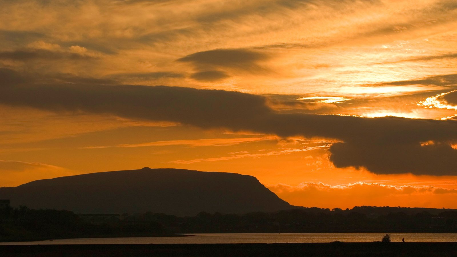
You can park in the car park at the foot of the mountain and then it’s a 30-minute walk to the summit and the cairn. The cairn is 200 feet in diameter and 35 feet high. Over 40,000 tons of rocks make up this great burial mound and it’s been dated at 6000 years old. You also get a spectacular view across Sligo Bay from here.
Keshcorran Caves
There wasn’t a cloud to be seen anywhere the day I visited Keshcorran caves. The sky was deep blue and the sun shone vividly down, illuminating the mountain as I drove towards it. A passage cairn was clearly visible on the top. As I rounded the corner a row of seventeen spectacular limestone caves came into view on the side of this imposing hill.
This vast collection of caves lining the entire side of the hill is home to the Sidhe (Fairy Folk), and the place where the goddess Morrigan lives. She is a fierce protector of this dwelling and of Corran, chief harpist of the Tuatha dé Danann. One day when Finn McCool and the Fianna were hunting here the Morrigan appeared as three hags winding wool in one of the caves. When Finn and his warriors came upon them, they became weakened by the enchanted threads being woven, and the hags overpowered and tied them up. As more of the Fianna arrived they all suffered the same fate, until Goll MacMoranna outsmarted and killed two of them. The third he allowed to live in return for reversing the spell and releasing the captives.
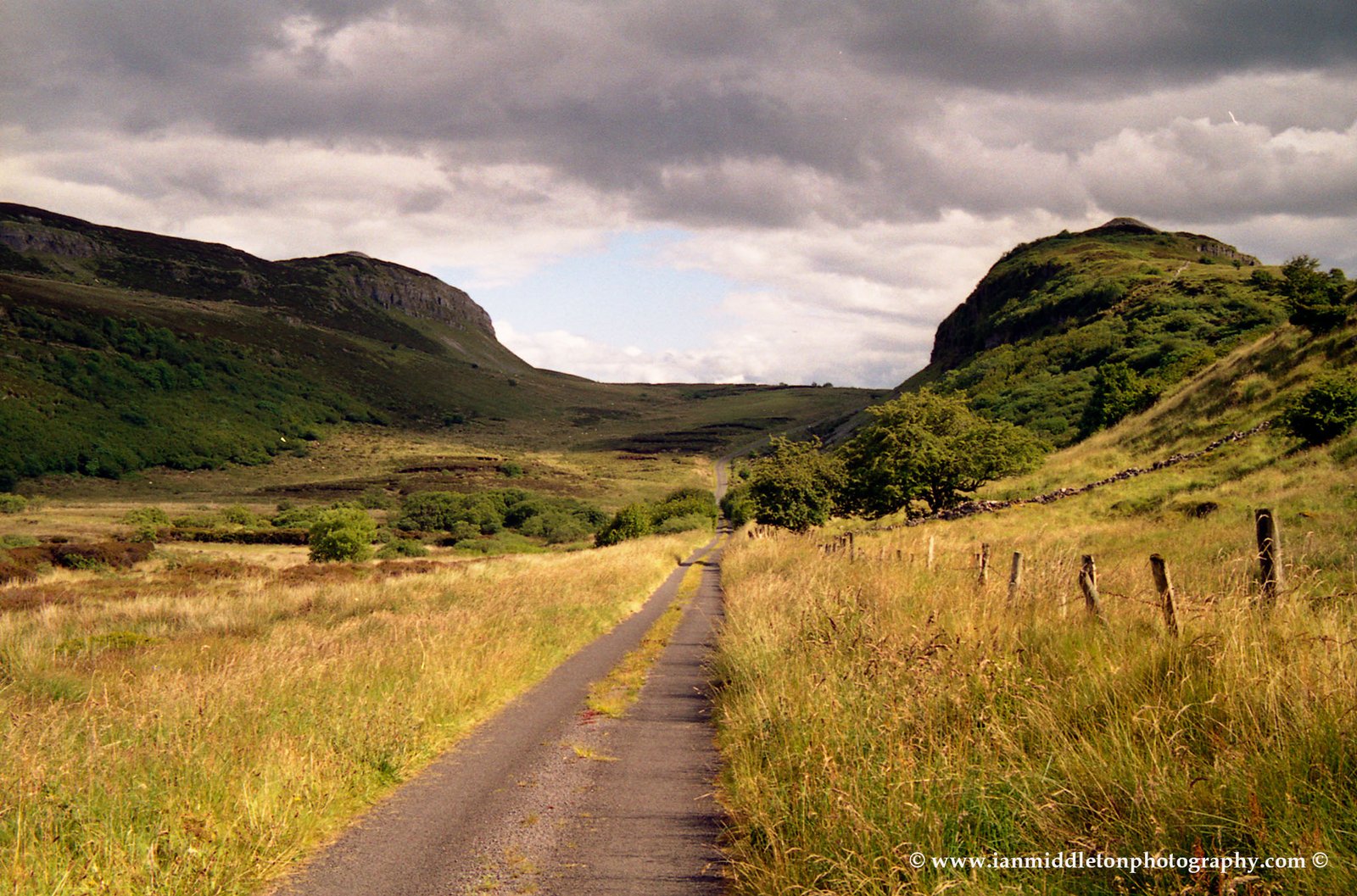
You can drive up quite close then park in a grassy lay-by on the right. Climb over a brown gate and a muddy path leads up through a small row of trees and up the hill to the caves. Most of the caves are small and narrow crevasses in the chunk of exposed limestone. But the caves on the left are the largest.
The views are tremendous. There is a cairn on the top, and it’s the highest in Sligo. Locally it’s called the pinnacle, and is perched in such a position as to give a 360-degree view of the plains of Sligo.
Carrowkeel
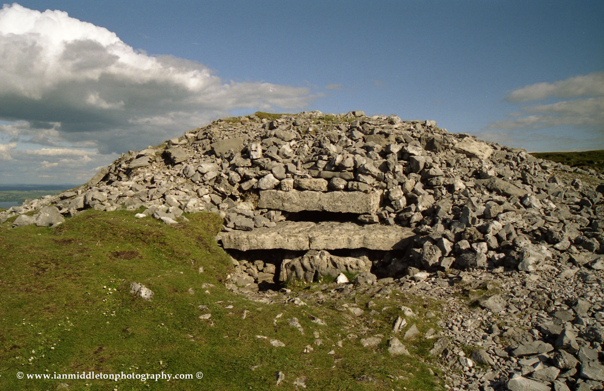
Breathless, this is the only word I can think of to describe the feeling when you enter this valley in the Bricklieve Mountains, where the megalithic cemetery of Carrowkeel lies. As you drive in, on the right-hand side, is a single passage cairn perched on the edge of the hill, its doorway facing outwards almost as if it is guarding the entrance to the valley. As you emerge over the brow of the hill to the right, you are greeted by the sight of five limestone cairns scattered across several levels of the hill.
There are around 14 cairns in this region, each designated with a letter. Two have completely collapsed. Cairn G has a collapsed roof, but the other two are accessible.
If you like, you can also stay nearby at the Carrowkeel Camping & Caravan Park.
Carrowmore
From Sligo town you can take the R292 towards Strandhill and follow the signs to Carrowmore, just a mile or so from Knocknarea. Covering an area of 1.5 square miles, this is Ireland’s largest megalithic cemetery, and it has been agreed that it’s also the oldest and predates the complex at Newgrange. At an archaeological conference in Sligo the experts came to the consensus that Ireland’s megalithic period boomed between 4200-2500BC. These findings were significantly characterised by excavation at Carrowmore. Entrance is via the visitor centre where a guide will take on an interesting tour around the main complex.
Back in 1837 there were as many as 66 tombs here, but now only around 33 remain. These are mostly dolmens and a few stone circles.
Getting to Ireland
Dublin is the main airport for the Rep of Ireland, or else Belfast in Northern Ireland. If you are coming from within Europe then the following airlines are worth looking at.
Wizz Air: Personally I have always found them to be the best and offer the lowest fares.
Skyscanner: A great place to search and compare flights
Ebookers: Ebookers have been around for longer than most and have always offered a great choice of flights.
Getting around
CAR
The best way to get around Ireland is by car. Either take your own car or you can rent one easily from Dublin or any other major city. Here are three great places to look:
BUS
The national bus service connects most major cities, towns and villages and is a good way to get around, especially if you want to meet some locals
If you want a fun way to travel with other like-minded travellers then try the Paddywagon
TRAIN
The national train service also serves a lot of the larger towns and cities. Great for getting from one side of the country to the other.
Tours:
Roc Tours Ireland – Great private driver tours all over Ireland. (Highly Recommended)
Accommodation
Holidu: This is a great website to search for a variety of places to stay.
Hostelworld: If you are looking for budget accommodation then Hostelworld is a great place to search for a variety of backpacker hostels, B&Bs and hotels.
Wild Atlantic Way Part 1
Wild Atlantic Way Part 2
Wild Atlantic Way Part 3
My Ireland Book
Read the story of my first ever trip around Ireland in my book, Hot Footing Around the Emerald Isle.
With just a backpack as a home, a guidebook in one hand, a bizarre travelogue in the other and very little money in my bank account, I leave my home and set off to this little country that has always been my neighbour, yet overlooked by myself for many years as I pursued dreams to travel to far and exotic countries. However, I was soon to learn that one of the most beautiful places in the world was right on my doorstep.








One Response